Many war documents have been digitized since the beginning of the WWI centenary, and now that list of documents has been expanded to include trench maps. Using a system which works similar to Google Earth, viewers can click and drag to explore the expanse of WWI battlefields and see just how much ground they covered in comparison to what the land looks like today. There are over one hundred trench maps digitized so far.
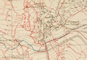
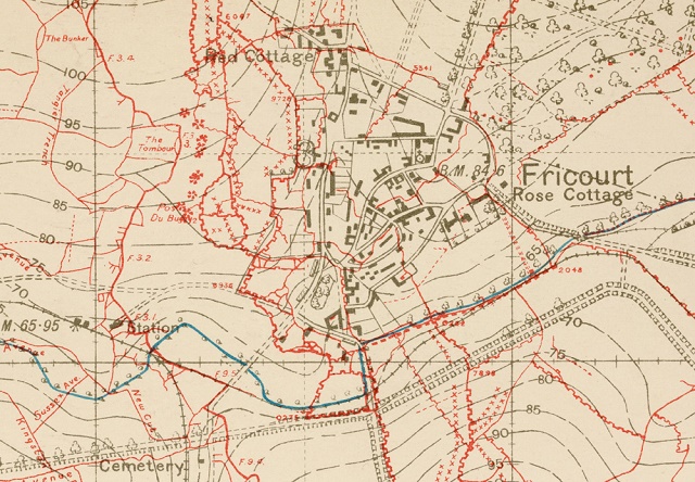
The battlefields which can now be explored by internet users are primarily located in Belgium and France. Many aspects of each war zone can be examined, from the locations of troop placements and the names of surrounding terrain features. The size of the no man’s land between the trenches can also be accurately gauged by the trench maps. These are designed with their own method for referencing, which is unique from the referencing used by other forms of cartography. Analysis of these systems in comparison to more modern ones illustrates that the landscape has changed greatly since the First World War.
World War I changed the way in which wars were fought, and it was incredibly necessary for military officers to use these documents to ensure careful strategic planning. Literally millions of trench maps were made, which helped officers to assess possible battle strategies as well as estimate the possible locations of land mines. These maps are highly detailed, and the new viewing system allows users to organize them by location while deciding which mapping system they would like to use.
This digitization effort will provide users with an in-depth look at how important conflicts, such as the Battle of the Somme, were arranged. The use of these heavily detailed trench maps allowed armies to see where the enemy might have been hiding. Looking at them today allows people to see how attacks would have been planned based on this information, as well as how armies would have set up their defenses based on the enemy’s position, the Mail Online reports.
Trench maps were an important part of the formation of military stratagem during the First World War, but never before have so many of them been available for online perusal. This is a big part of the general increase of informative materials regarding WWI which has been on the rise since the beginning of the centenary. These trench maps allow viewers to see how the battles of the war were enacted from the viewpoint of those who actually planned them, which is important to understanding how the war was fought.